| |
Welcome to the | |
| |
AACES-2 Project | |
| Australian Airborne Cal/val Experiment for SMOS |
|
Home page
Google Earth (KML file) Workplan SMOS AMSR-E WindSat ASCAT PALSAR ASAR MODIS MTSAT-1R ASTER Landsat CHRIS AVNIR-2 PLMR data Thermal Infrared data Multi-Spectral data Monitoring stations Soil moisture sampling Vegetation sampling Campaign shapefiles DEM Land use Climate data Soil classification Soil water capacity Soil texture analysis AACES homepage Moisturemap homepage |
Thermal Infrared data (TIR)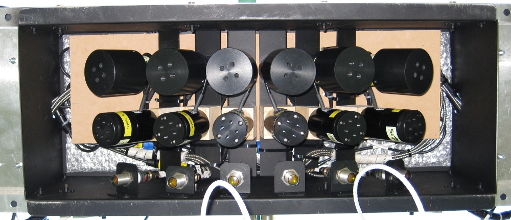 Sensor box with 12 multi-spectral sensors (two upper rows) and 6 thermal infrared sensors (bottom row)
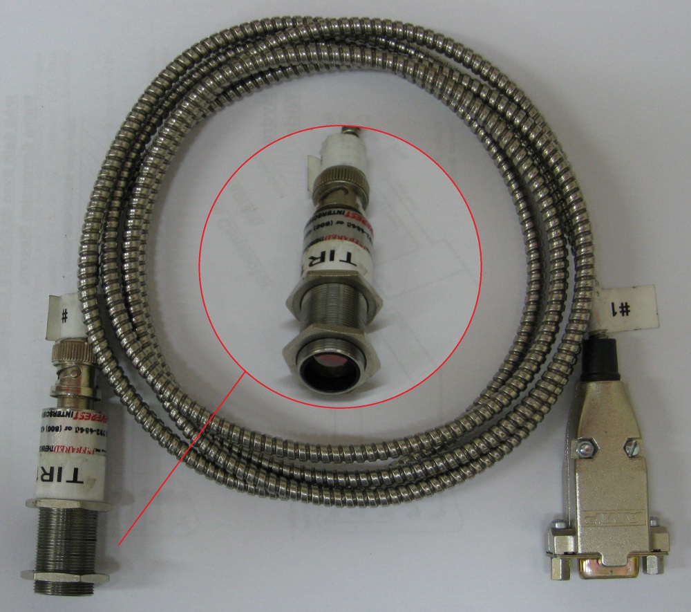 Thermal Infrared sensor
During the airborne data acquisition there were 6 thermal infrared radiometers (top picture: bottom row sensors) with additional 12 multi-spectral sensors operational (top picture: first 2 rows of sensors). The thermal infrared radiometers used are the 8.0 to 14.0μm Everest Interscience 3800ZL with 15°FOV and 0-5 V output (-40°C to 100°C). The six TIR sensors are installed at the same incidence angles as PLMR (±7°, ±21.5° and ±38.5°), so as to give coincident footprints with the PLMR observations. The nominal relationship between voltage and temperature is given by the manufacturer as V = 1.42857 + (0.03571428×T). All collected thermal infrared data can be requested from Dr. Chris Rüdiger: Chris.Rudiger@monash.edu |
|
Created: September 2010 Last Modified: September 2010 Maintainer: YE Nan, Ye.Nan@monash.edu |